This article describes our Top Three Favorite Hikes in Sedona, Arizona, including a summary of each hike.
Sedona, Arizona is one of the most beautiful places to hike in the U.S. and is one of our favorite hiking destinations. Compared to other popular hiking destinations in the southwestern United States, Sedona is fairly easy to get to, the hikes are very accessible and the scenery is always spectacular. Enjoy our Top Three Favorite Hikes in Sedona!
Travel Tip: Sedona has limited parking at all trailheads and most require a parking pass. You can use a Red Rock Pass or a U.S. National Park Pass that must be displayed on the your dashboard of your vehicle. Some of the trailheads have a kiosk where you can purchase a day pass or you can purchase them on-line here.
Travel Tip: Due to the heat in the summer and limited parking at trailheads, it is best to arrive early and finish the hike by 11:00am or 12:00pm or do the hike later in the day when the parking lots have emptied again and the afternoon heat has waned. For a shorter hike, consider doing it as a nice sunset activity…as long as you have given yourself ample time to make it back before dark! If you can go off season, parking at trail heads is not an issue and the hiking is amazing.
Note: The hiking times on Google Maps are not accurate. More realistic times are listed in the summary table for each hike.
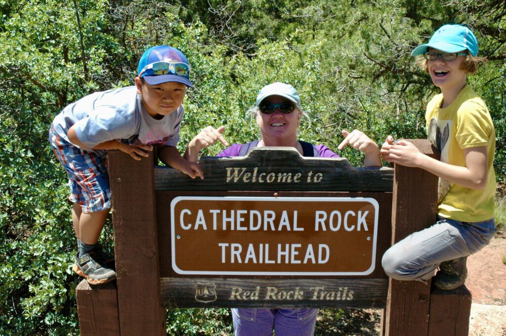
Cathedral Rock and Vortex Hike
Bell Rock and Courthouse Butte Loop Hike
Soldiers Pass Hike and Cave Spur Hike
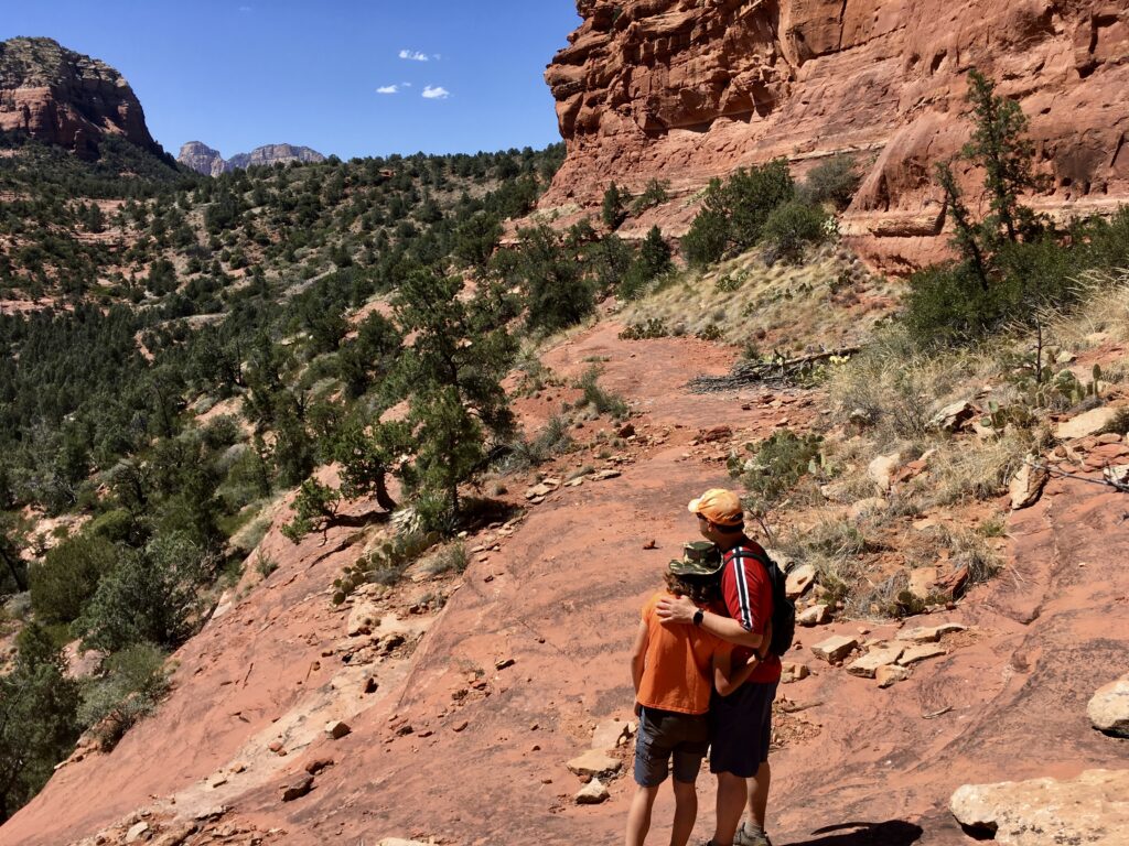
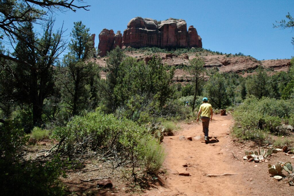
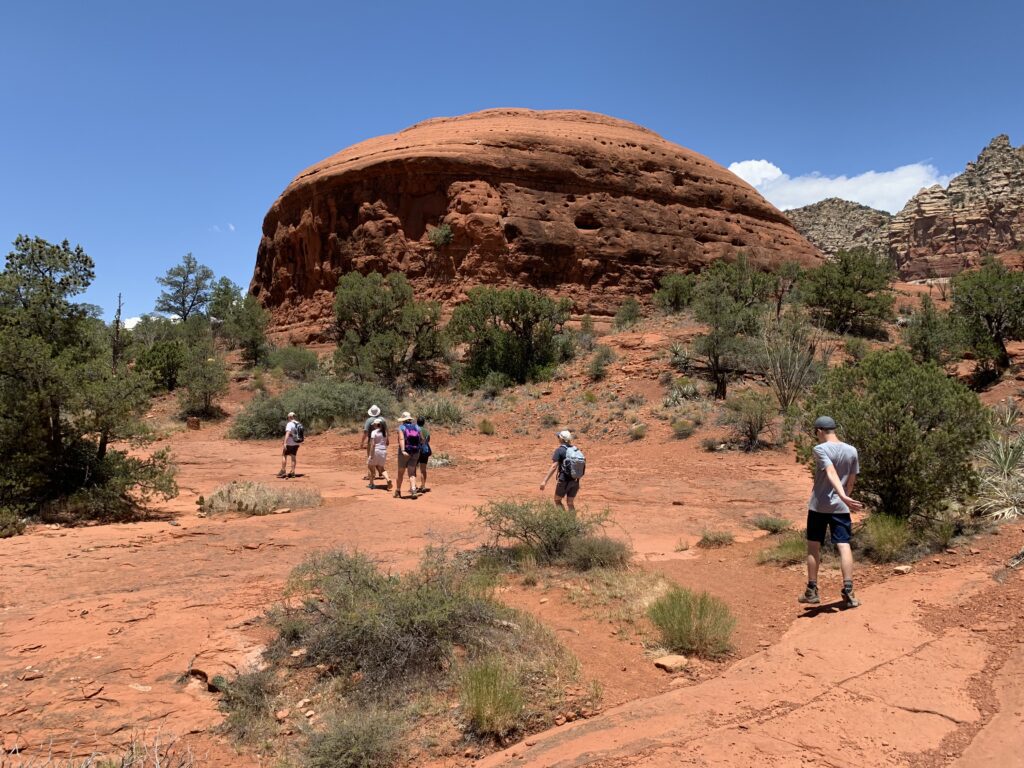
Cathedral Rock and Vortex Hike
Summary
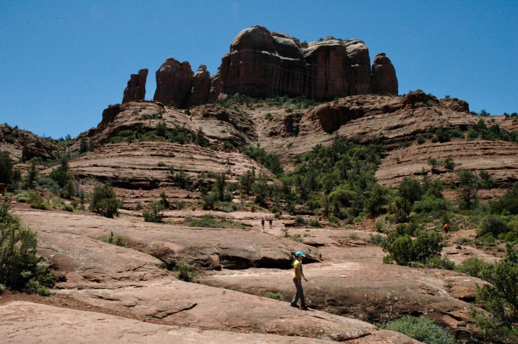
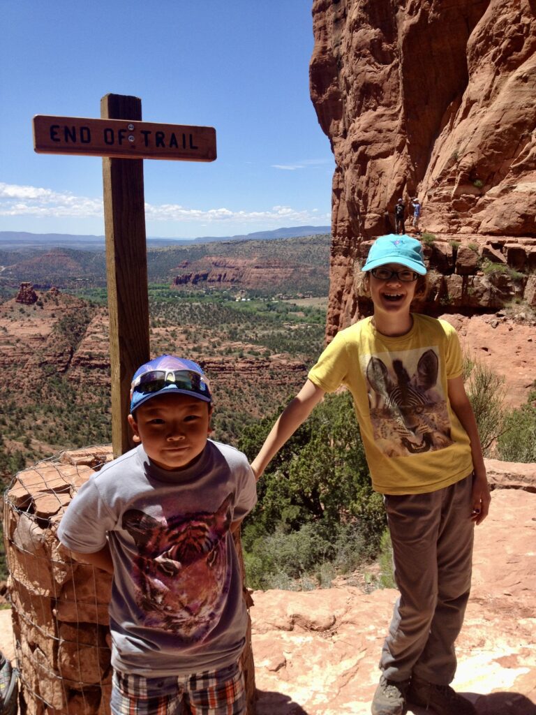
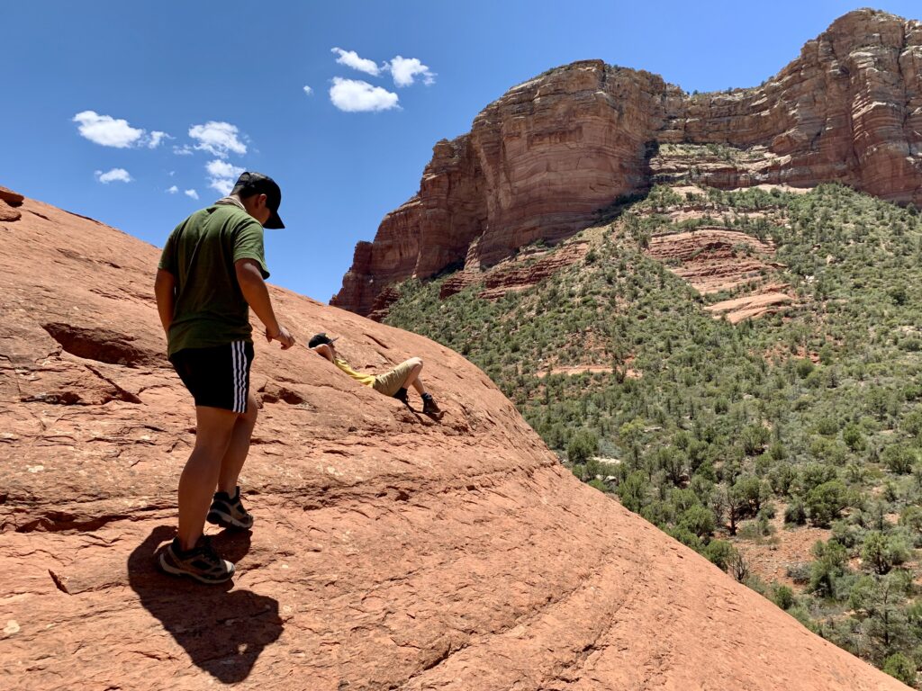
This hike is a steep and sunny out-and-back hike to the saddle of Cathedral Rock where you will have amazing views. There is some fun scrambling up slick rock at the beginning of the hike where you will quickly learn if this trail is for you or not! This is definitely NOT a quick flip flop trail even though it looks short. One of Sedona’s famous vortex sites is accessed off this trail. This is one of our favorite hikes because it’s challenging, has really fun slick rock climbs, and getting to the top is so rewarding!
| Total Distance | 1.2 miles (1.9 km) |
|---|---|
| Elevation Gain | 741 feet (226 meters) |
| Typical Time | 1.5 to 2 hours |
| Difficulty Level | Difficult |
Getting There
Access this hike at Back O’Beyond Trailhead, located near the end of Back O’Beyond Road. Coming from Sedona, Back O’Beyond Road is located off of the fifth roundabout, turning right on Route 179 (not counting the main intersection at Route 89A and Route 179). If you are coming from the south, turn left at the first roundabout after the divided highway joins back together.
Travel Tip: Parking is prohibited at these lots from Thursday through Sunday to avoid congestion and traffic jams. On these days, access to this trailhead is only by the free Sedona Shuttle service or by using Uber or Lyft.
The Hike
This hike starts by crossing a creek bed and winding through a lightly forested area until you get to the slick rock. The lower sections of slick rock are not too difficult to climb. As you cross over the Templeton trail the Cathedral Rock trail becomes ever steeper and sections require scrambling. The slick rock becomes very slippery when wet; keep in mind that coming back down can be more of a challenge than going up.
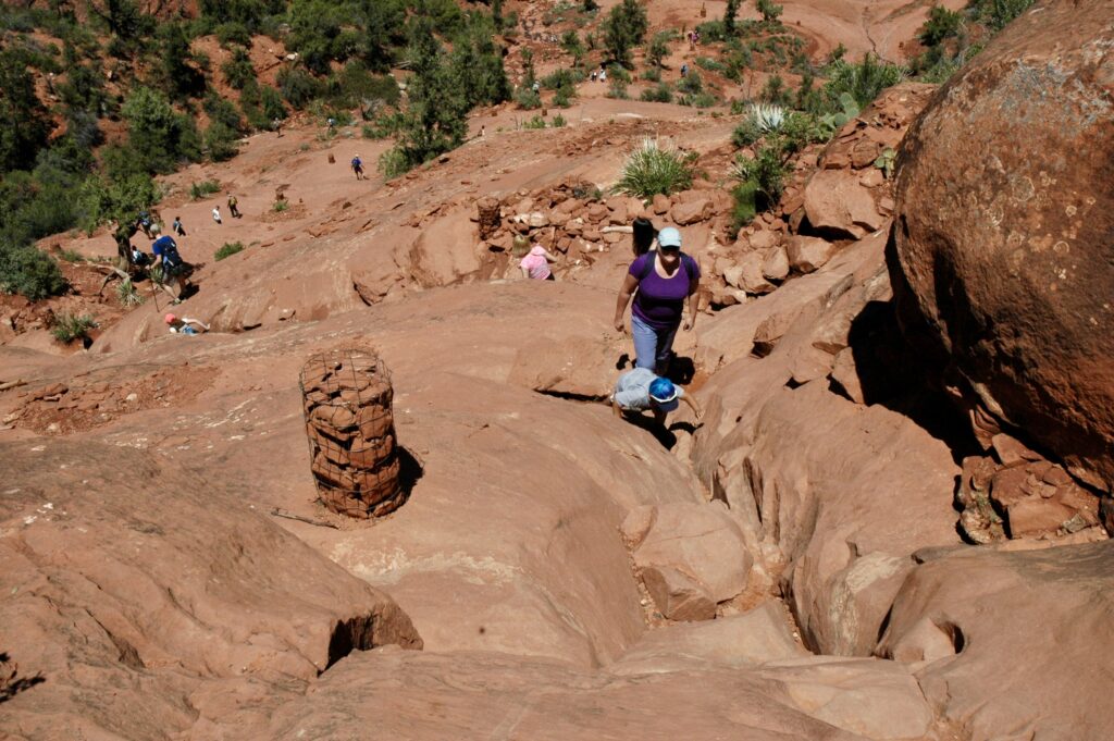
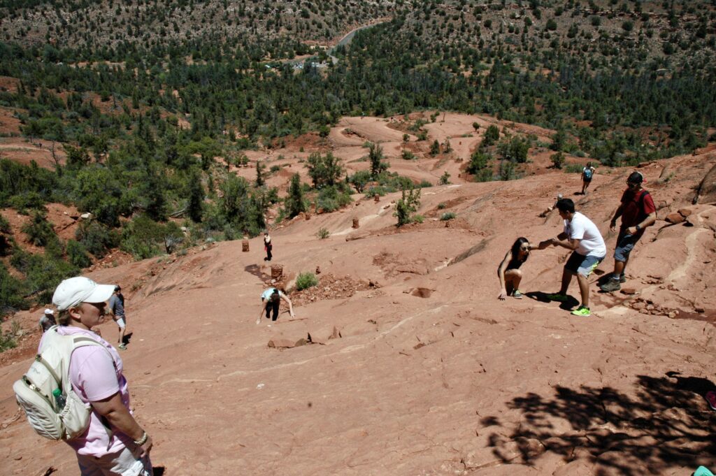
As you near the saddle, the hike becomes less steep. There are a few shady spots where you can rest and cool off before making the final push to the top. As you reach, the top, the spectacular view spans rock formations in all directions and Oak Creek below. Explore some of the small trails for more fantastic views. Mind your footing as there are lots of loose rocks and slippery sections here.
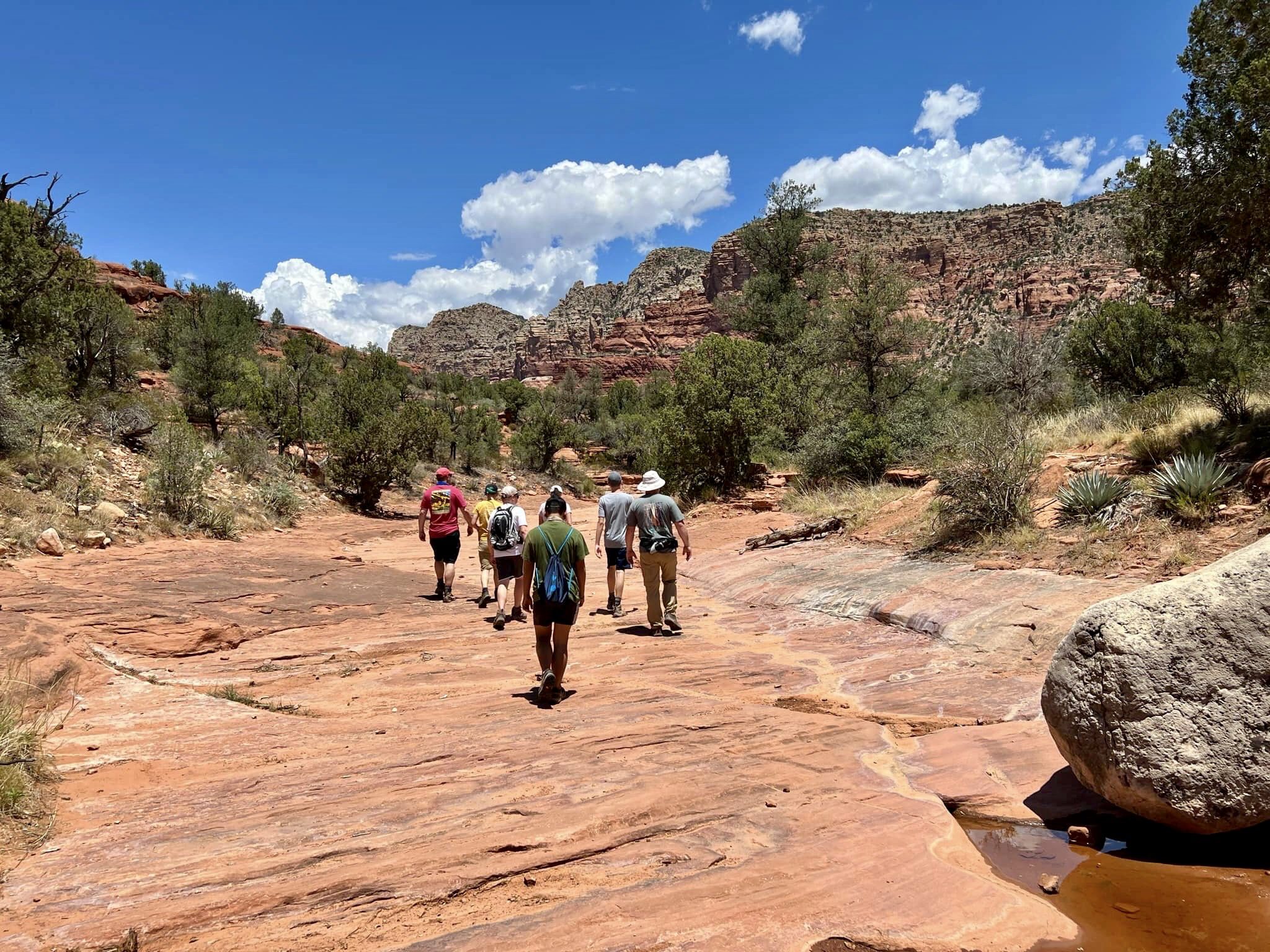
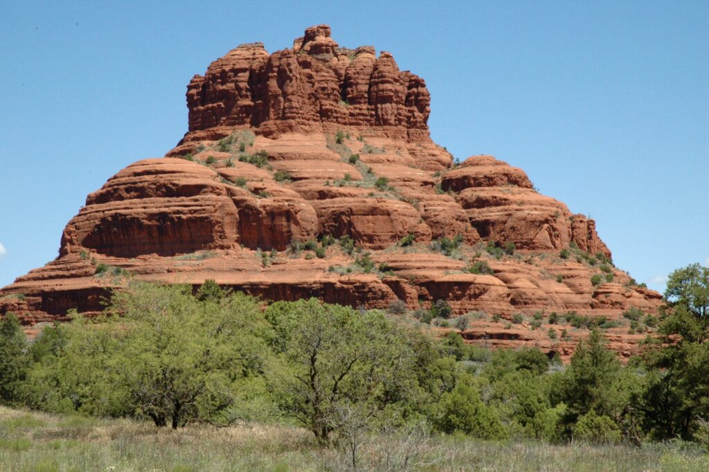
Bell Rock and Courthouse Butte Loop Hike
Summary
This hike is a moderate loop hike through desert trees, shrubs, and slick rock that offers excellent views of Bell Rock and Courthouse Butte. This is one of our favorite hikes in Sedona because, although Bell Rock can be popular and busy, we have never found this overall loop busy as we continue around Courthouse Butte. The terrain varies so this hike has a lot of interest and lots of fun climbing along the way.
| Total Distance | 4.2 miles (6.76 km) |
|---|---|
| Elevation Gain | 500 feet (152 meters) |
| Typical Time | 3 to 4 hours |
| Difficulty Level | Moderate |
Getting There
There are three trailhead parking areas near this hike: Courthouse Vista Trailhead, Bell Rock Vista Trailhead and Yavapai Vista Trailhead.
Courthouse Vista Trailhead provides the closest trail access and is located directly off of Route 179 at the upper area of Bell Rock. This is our preferred trailhead for this hike.
If you cannot find parking here, the next closest trailhead is Bell Rock Vista Trailhead, just south of Courthouse Vista Trailhead. It’s directly off Route 179 on the northern edge of the Village of Oak Creek. Parking at the Bell Rock Vista Trailhead will require you to start the hike from below Bell Rock and get to the Big Park Loop trail that runs below Bell Rock and Courthouse Butte. This will add an additional mile (1.6 km) to your hike because it turns a loop hike into a lollipop hike.
The farthest trailhead that is still within reasonable walking distance, is the Yavapai Vista Trailhead located just north of the Courthouse Vista Trailhead. It is only accessible via the southbound side of the divided Route 179. Parking at the Yavapai Vista Trailhead will require you to hike north to the Templeton Trail, then back south going under Route 179 until you intersect the Bell Rock Pathway. Proceed south on the Bell Rock Pathway then onto the Phone Trail, which will take to the Courthouse Vista Trailhead. This will add an additional 2 miles (3.2 km) to the overall hike, turning the loop hike into a lollipop hike.
The following description assumes you parked at the Courthouse Vista Trailhead.
The Hike
We have always done this hike in a counter-clockwise direction so that is the way we describe it. Doing this hike in the other direction would also be fine. You really can’t go wrong!
As you proceed from the trailhead parking lot, head south towards Bell Rock. Almost immediately, you come across a three-way intersection. Taking the center path will take you directly toward the base of Bell Rock, while taking the right path takes you further to the right of Bell Rock. Either way is fine for this hike, but the center path provides more opportunity to scramble around Bell Rock before continuing on the full hike.
After leaving the upper base of Bell Rock, head south down the wide Bell Rock Pathway until you reach the first intersection at the lower base of Bell Rock. Turn left onto the Big Park Loop trail, keeping Bell Rock and Courthouse Butte to your left.
In approximately 0.8 miles (1.3 km), you arrive at a dry creek bed and a four-way intersection. This is a good place to stop for a rest and have a snack or lunch. You may even find some shade.
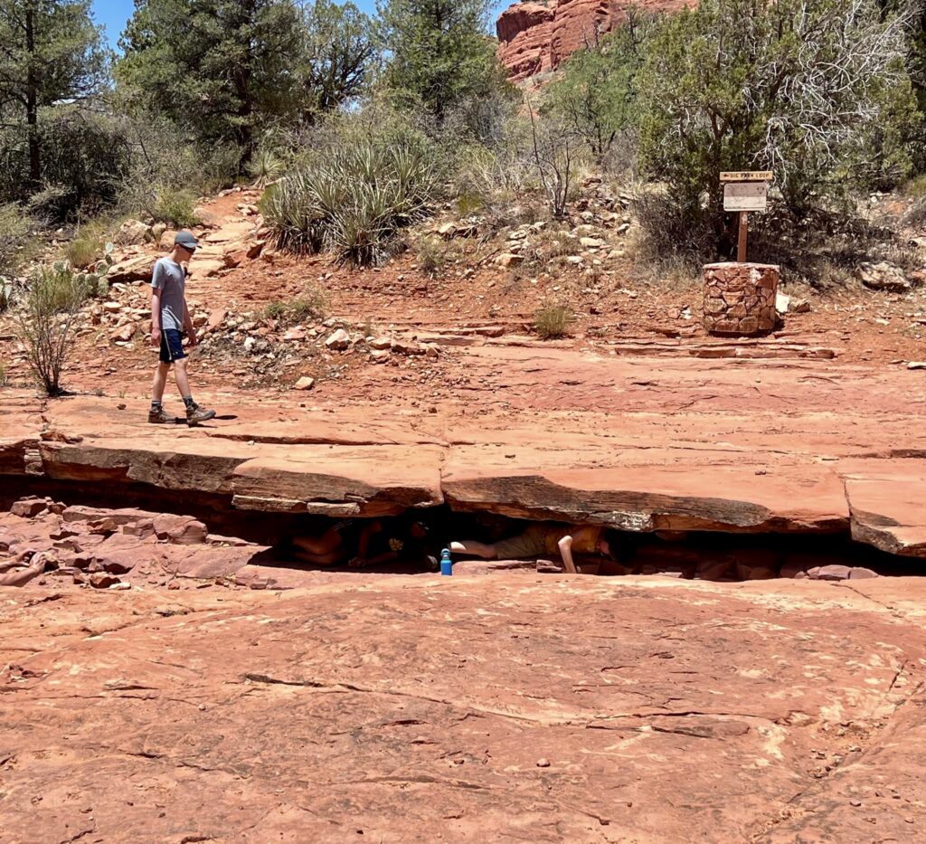
After resting (or not), make your way up the dry creek bed (there is also a trail just to the right of the creek bed) keeping to the left. You will eventually get to the muffin rock.
We like to climb to the top of muffin rock and take in the views.
When finished at muffin rock continue north always keeping Courthouse Butte to your left. Eventually you will get to another intersection where you will want to keep left to get back to the Bell Rock Pathway and the upper base of Bell Rock. If you did not climb around on Bell Rock at the beginning, and you still have energy, you can do that now. Otherwise you can return to the trailhead parking area.
Soldiers Pass and Cave Spur Hike
Summary
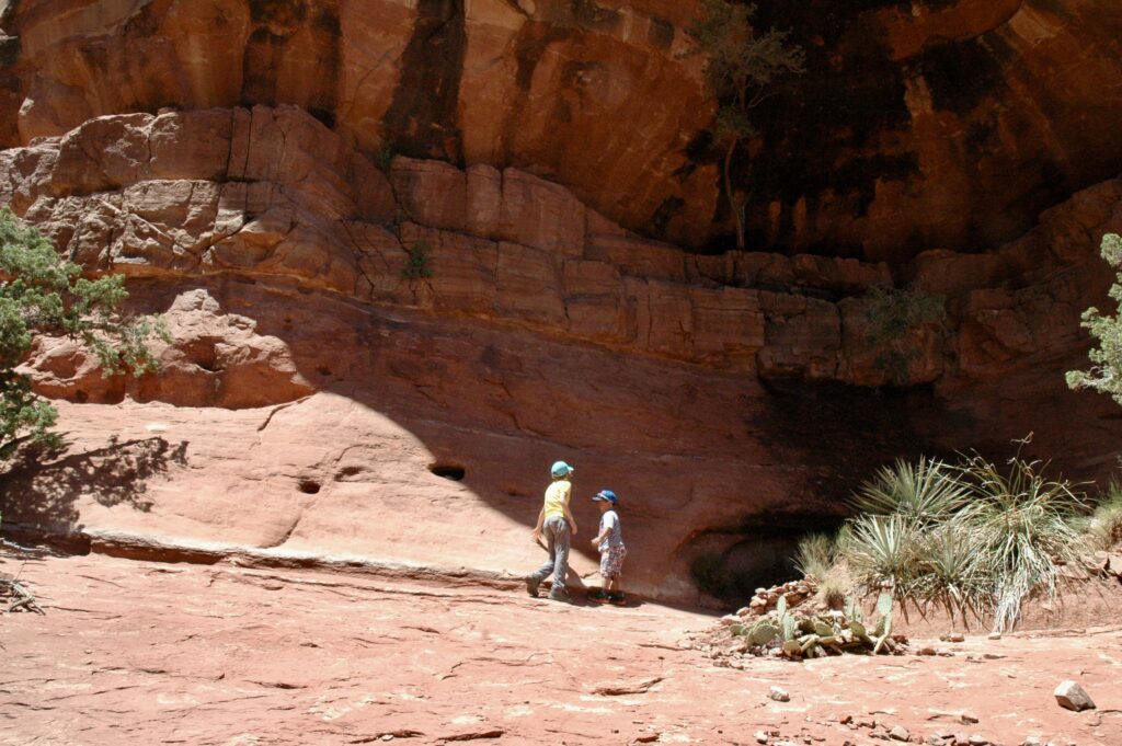
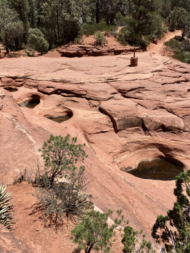
This is an out-and-back hike where you will pass by the Devil’s Kitchen, the largest sinkhole in Arizona, and the Seven Sacred Pools. You can also get to a really cool cave from this trail. Climbing up to the cave or making your way up Soldiers Pass provides great views of the valley in which you just hiked and will have to hike back down. This hike is one of our favorites because of the interesting features: the sinkhole, the Seven Sacred Pools, and the cave.
| Total Distance | 6.4 miles (10.3 km) |
|---|---|
| Elevation Gain | 862 feet (263 meters) |
| Typical Time | 3 hours |
| Difficulty Level | Moderate (Difficult if you include the hike up to the cave) |
Getting There
Soldiers Pass Trailhead is located at the end of Soldiers Pass Road which is directly off 89A in West (Uptown) Sedona.
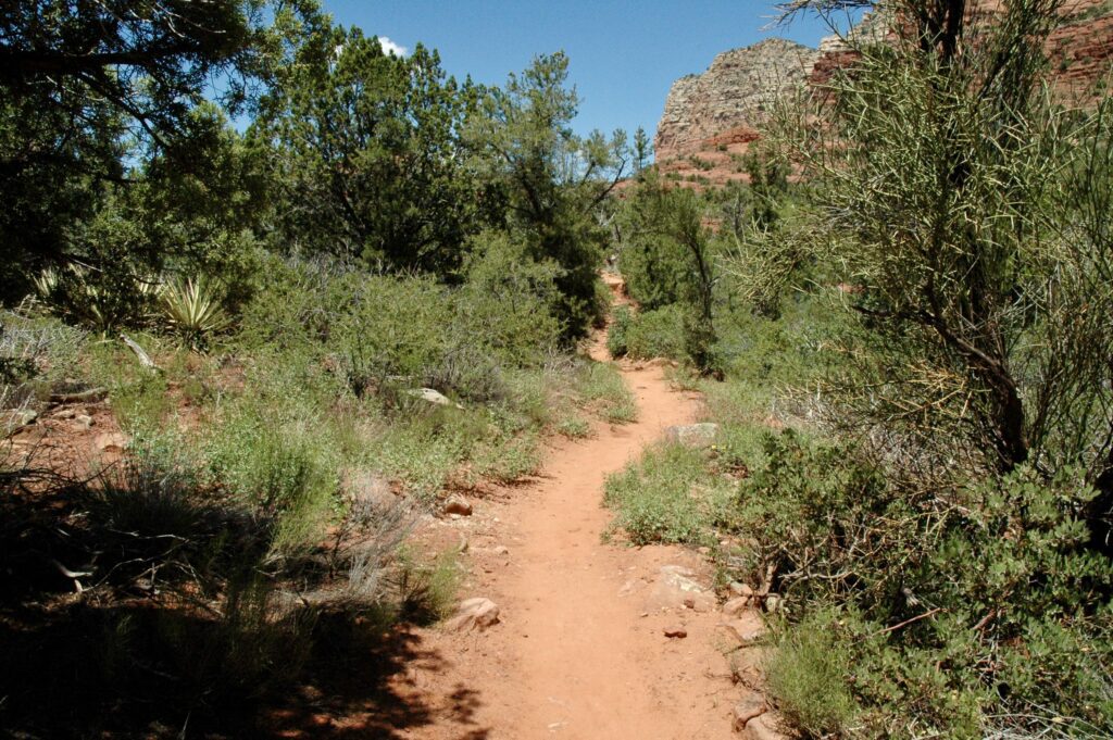
The Hike
From the Soldiers Pass Trailhead, it is a short 0.2 mile (0.32 km) walk to the intersection with Jordan Trail and Devils Kitchen, which is the largest sinkhole in Sedona. After admiring Devils Kitchen head north up the valley. Coffeepot Rock will be to your left.

Continue up the trail another 0.6 miles (1 km) or so and you will come across the Seven Sacred Pools. This is a popular spot for guided Jeep tours as well as with hikers and mountain bikers.
As you continue up the trail, keep looking to the right for arch shaped openings in the rocks above. One of these is the opening to a small cave. There are no official trails going up to the cave, so you have to take a chance and climb up one of the unofficial trails to look around for the entrance. The other option is to continue up the trail, up Soldiers Pass, and loop around to the right to get on Brins Mesa Trail. From here you will need to look for an unofficial trail on your right that will take you to the edge of the mesa and to the top of the cave.
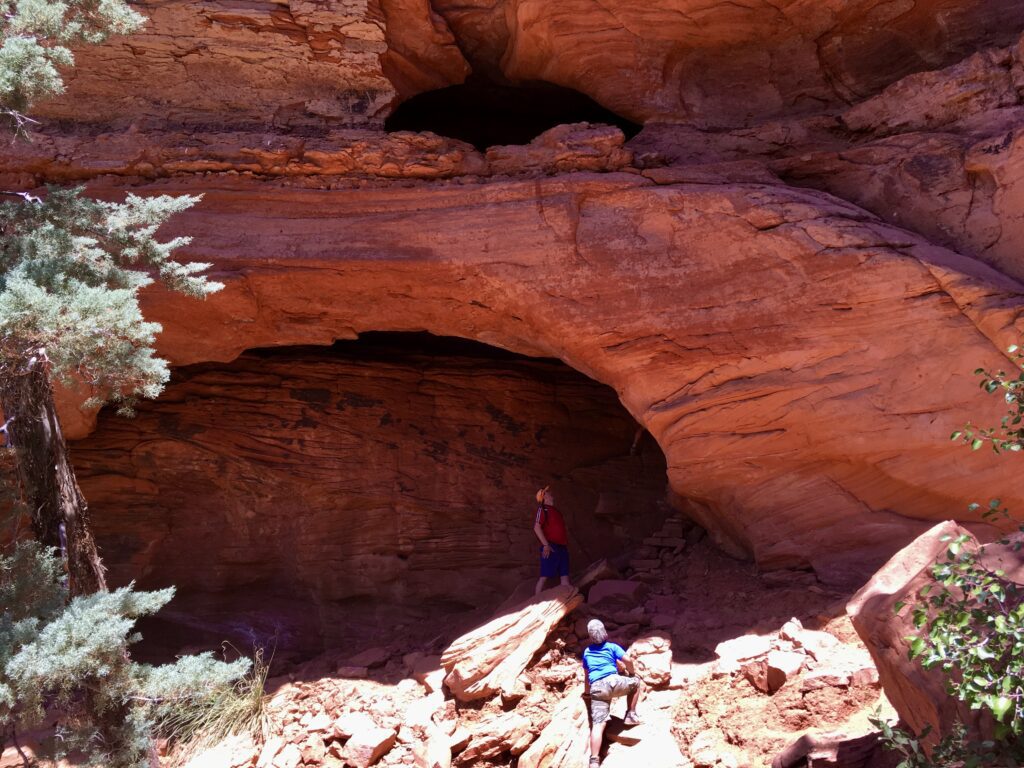
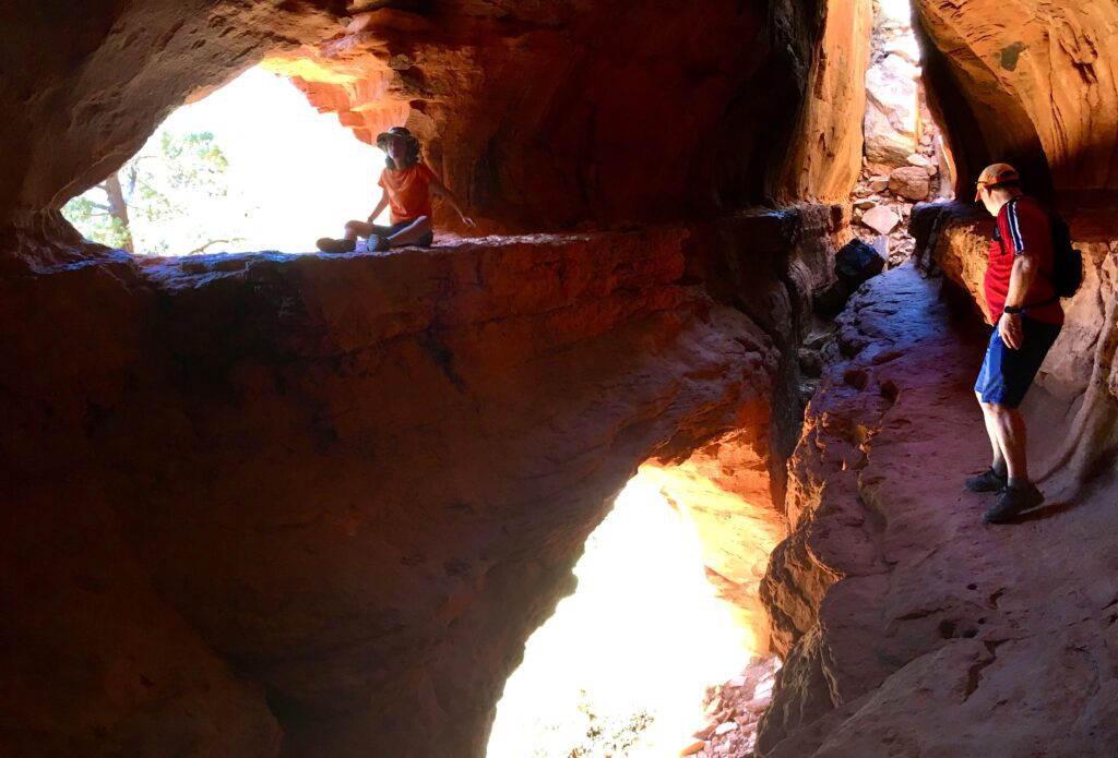
Once you’ve explored the cave and admired the views you can head back down the valley.